


Frequently Asked Questions
- Why is Howard Hughes submitting plat applications for all of its undeveloped land intended for commercial use in The Woodlands?
Howard Hughes is submitting for two primary reasons:
- We are presenting the areas we envision for future commercial development in the interest of transparency. We know residents are curious about our plans, and sharing this information eliminates the need for speculation and the spread of misinformation. It also affirms our commitment to completing George Mitchell’s vision for a cohesive master plan for The Woodlands.
- During a time of uncertainty surrounding the future governance structure of The Woodlands, it is important to note that we will develop these properties in a way that is consistent with George Mitchell’s vision, our long-standing covenants and design standards, and in keeping with every other development we have overseen in The Woodlands—whether it remains a township or becomes a city.
- What is the total amount of land the plat applications represent and where are they located?
The plats represent approximately 2.5% of the total acreage of The Woodlands –– approximately 700 acres – located primarily in the Town Center and along commercial corridors such as I-45, FM 1488, FM 2978 and Kuykendahl Road, where commercial development already exists.
- What impacts will the development of these plats have on Woodlands Parkway?
We have seen misinformation shared and have heard resident concerns about the possibility that Woodlands Parkway will eventually become like FM1960. As our interactive map indicates, this will never be the case. Howard Hughes has virtually no additional development sites along Woodlands Parkway. Existing covenants placed upon the land along Woodlands Parkway also ensure of its ultimate preservation.
In addition, Woodlands Parkway will not extend beyond FM2978. We have recorded a plat on the property west of the intersection that once developed, would not include an extension. In addition, Commissioner James Noack and Commissioner Charlie Riley have requested that the extension be removed from the major thoroughfare plan and for Woodlands Parkway to terminate at the intersection of FM2978.
- What is the difference between a plat approval and a project approval?
Platting is the first step in a multi-step process required for development. Over The Woodlands’ 46-year history, every parcel of land we have developed as part of the master plan has been subject to the same plat approval process.
A plat application requests that a subdivision of land be legally defined and approved for future development. To be approved, a plat application must reflect access to streets and public right-of-way and must abide by all development standards and ordinances established by the City of Houston and Harris/Montgomery County.
Plat approval does not establish a timeline for development, nor does it signal that a project is imminent. It is separate from a project approval process.
- What is the timeline for the development of these commercial properties?
Site-specific timelines have not been determined for the development of these properties.
Although we plan to develop each of these commercial properties over time, we will do so thoughtfully and methodically over the course of the coming years, according to market demand and economic indicators.
- Does the plat approval process take into account storm management, traffic and tree removal?
As with all of our projects, storm water management, traffic and tree removal will be carefully considered on a project-by-project basis prior to the start of any development. We will abide by all covenants and design standards (including required forest preserves and landscaping requirements), just as we have for the last 46 years of this master planned community.
The plat approval process is separate from a project approval process.
- What will be the process for getting these plat applications approved?
Over The Woodlands’ 46-year history, every parcel of land we have developed as part of the master plan has been subject to the same plat approval process.
Each plat application is evaluated separately after being submitted to the City of Houston for review. Once approved by the City of Houston Planning Commission, the plat and all supporting documentation is submitted to either the Harris Co. or Montgomery Co. Commissioners Court for approval.
- What kind of an investment in the community would the commercial development of these properties represent?
Over the past 46 years, The Woodlands has created a $20 billion tax base. Based on this value, the commercial development of 2.5% of its total acreage could conservatively generate in excess of $500 million additional assessed value subject to future sales and property taxes. Residential property taxes are low in The Woodlands due to our unique governance structure, as well as our existing commercial tax base. Expanding the commercial tax base will continue to play a critical role in keeping homeowners’ taxes low as the cost of governance increases over time.
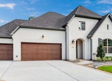
- How much residential property is left to develop?
We are coming to the end of our residential development in The Woodlands. With the exception of a very small area in Creekside Park and the remaining lots in East Shore, our residential development is complete.
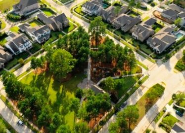
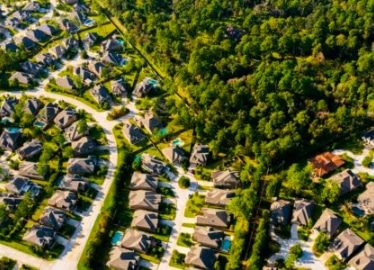
- How much open/green space will remain in The Woodlands at buildout?
Approximately 8,000 acres (an unprecedented 28% of The Woodlands) will remain as open green space after full build-out.